Unusually high precipitation combined with spring snow melt caused the water level in Chatfield Reservoir to reach a height of 5440 feet above sea level in May 2015. This is 4 feet lower than the maximum storage elevation of 5444 feet proposed by the Chatfield Reallocation Project. However, the following photos give some sense of parkland that reallocation would destroy.
Please keep several things in mind while viewing the photos:
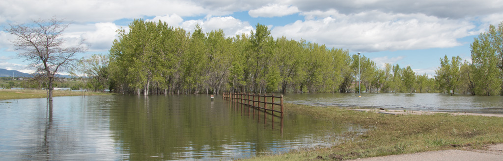
If reallocation is allowed, water levels in Chatfield Reservoir would fluctuate over a much larger range than they do currently. In wet years, which are expected to occur in 2 or 3 for years out of 10, non-flood water levels would reach 4 vertical feet above the levels shown in the photos. Because shorelines are sloped, 4 vertical feet translates into much more than 4 horizontal feet. Temporary flood-prevention levels would be even higher.
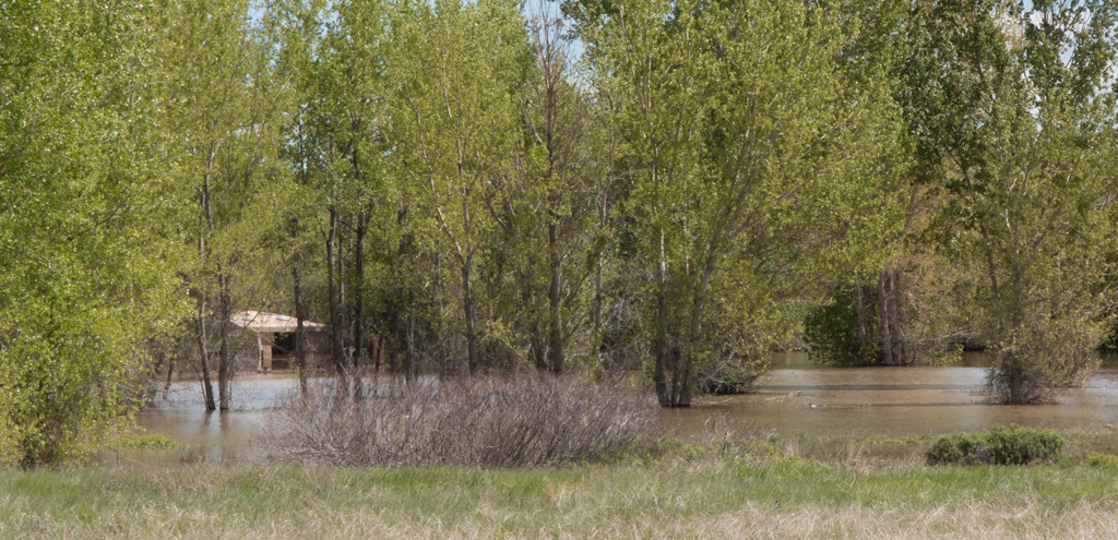
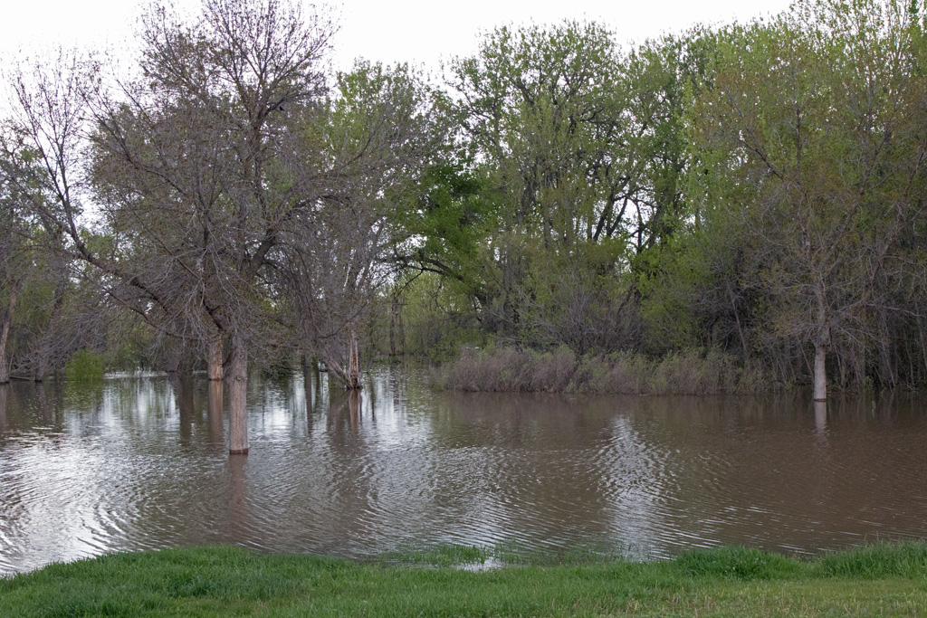
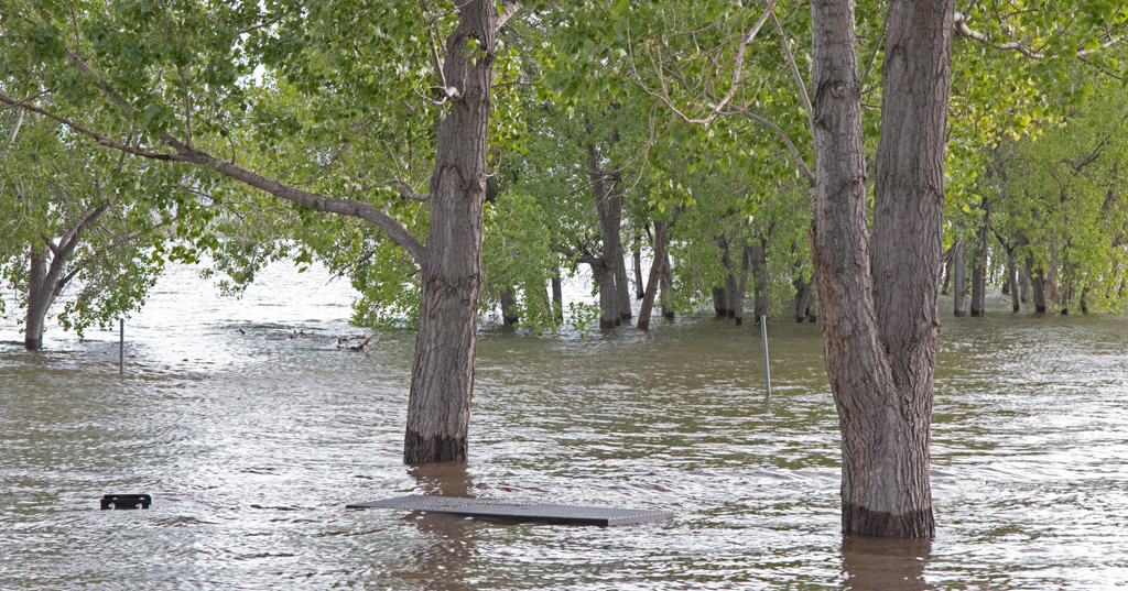
Trees can survive the kind of short term submersion anticipated for the 2015 flooding. Long term submersion like that proposed by Chatfield Reallocation would kill them.
In dryer years, water levels in Chatfield Reservoir would be near current normal water levels. However, the park would be changed dramatically. Partially submerged trees in these photos would be removed. Facilities would be moved to higher ground. In some cases, higher ground for these facilities would have to be created.
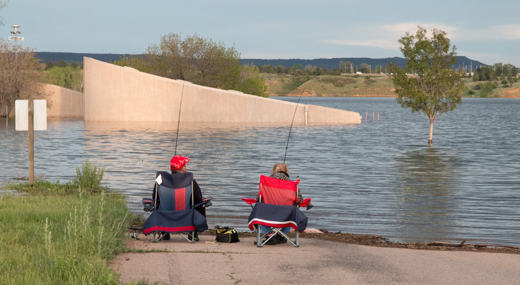
When water levels are low, as they are expected to be much of the time, the relocated facilities would be a long way from the shore. The distance between the bathhouse and the shore at the swim beach would be a particular problem for swimmers with small bladders, but the long distance to the shore would likely affect others as well. For example, long distances to the shore would make handicapped fishing and hand launching small boats more difficult.
Click photos to display a larger version. Use your browser’s back button to return to this page.
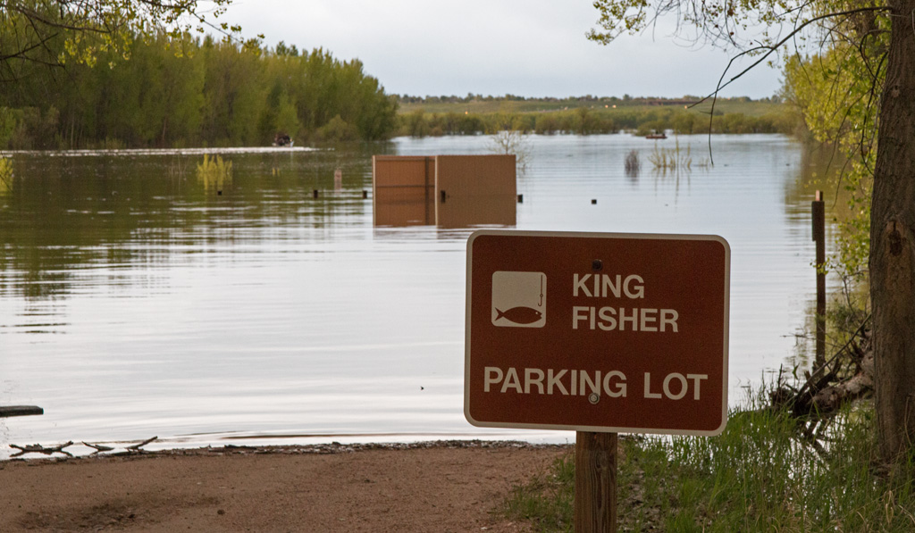
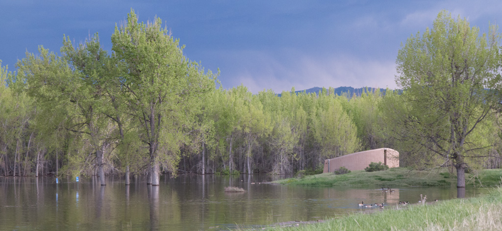
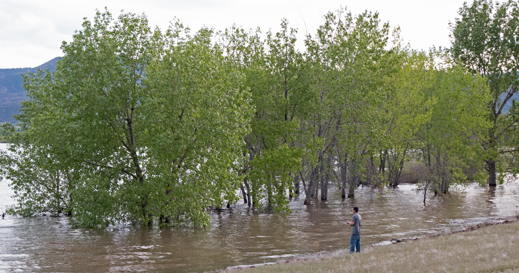
Road to the swim beach parking lot on May 14, 2015. The reallocation project would require major changes in this area. Ground would have to be built up for facilities like the bath house shown in this photo. A long walk to the beach would be required when water levels are low.Plum Creek area viewed from the south on May 17,2015. The restroom facility on the left side of the photo is at the southeast corner of the Plum Creek Picnic Area. During the winter a small herd of elk takes cover in these trees during the day. Long term submersion would kill the trees and leave the elk without shelter. They would have to be removed to keep debris from interfering with boating when water levels are high.Spit on the east side of the marina from the east marina parking lot on May 17, 2015. These trees would also be removed.Marina dock viewed from the east parking lot on May 17, 2015. If space in the reservoir is reallocated, major changes in the marina would be required to accommodate large fluctuations in water levels.Path to the handicapped fishing pier west of the marina on May 17, 2015. Trees is this area would also be removed.Kingfisher Parking Lot on May 14, 2015. This photo shows more forested shoreline that would be obliterated to accommodate reallocation.Jamison Picnic Area on May 14, 2015. Trees in this area would also be removed. In dry years water levels would be about where they are typically now — roughly 8 vertical feet lower than the levels shown in these photos. Imagine what the area would look like without trees.Picnic area near the balloon launching site on May 14, 2015. Trees that would be removed in this area include a snag with a hollow top where great-horned owls recently nested and raised four babies.
Massey Draw Picnic Area on May 14, 2015. Note the grill and picnic table in the foreground. Plans call for moving this picnic area to higher ground that is currently treeless.A fisherman near the North Boat Ramp on May 14, 2015. This area would have to be build up to allow boats to be launched when water levels are high. These trees would be removed.